White Cliffs, Cobar to CondobolinThe next few weeks of our travels are to be in the area of New South Wales that they call “The Heart of NSW”; we leave the NSW outback to pass through greener pastures of pastoral farming, canola, wheat and barley, part of the NSW food bowl, east of the Great Dividing Range.
The four lovely days we spent in White Cliffs soon came to an end. We found the area to be a good place for some R & R time. This time of the year seemed to be just the perfect time to visit. Noodling for Opal hadn’t made us rich but meeting a distant relative and her family made up for this.
On our way south, I remembered a lonely gravesite which I had seen whilst going into White Cliffs. We stopped I guess, to pay our respects to the deceased. There were no details on the headstone only the name. We think that of a drover in the pioneering years. One can only imagine the harshness of the surrounding landscape that the deceased endured. It makes us appreciate how far we have come as a nation & to really think of what could happen if we are not prepared for any changes in the environment.
By early afternoon we decided to stop for the night. Our camp was at a rest area approx 120km out of Cobar. We were amazed at how much the landscape had changed since we travelled along the Kidman Way in 2006, when it was very dry & the farmers were droving their sheep & cattle along the roadside for feed. Some farmers were even moving their stock about 50km over the hills for greener pastures. Now, wild goats roamed the country-side and we saw many along the way, fat and well fed, the number of young kids testament to good times, (for the goats that is!). The wild goat is captured and sent for live meat export to the Middle-East. They breed quicker than they can be rounded up though.
Cobar is an interesting town with a population of approx 5,500. It has been a busy gold & copper mining town in the past. Gold is still being mined & it was interesting to view the current open cut gold mine. Not as big as the one in Kalgoorlie, nevertheless impressive. Further out of town we drove to another working Gold Mine. A walk around the Golden Walk which the organisation has developed was interesting, they have displayed several large rocks in which we could see some flecks of gold & peacock ore, some of the old equipment used & sketches of the mine & its contents at different depths.
The town has several reservoirs; the Old Reservoir used to be the towns water supply but is now used for recreation & watersports. It is also available for camping. In this area there is a place called ‘Devil’s Rock’ which is an ancient rock formation which according to Aboriginal legend / belief is known as being a place of evil. The Newey Reservoir being the new reservoir is much greener & in town; Newey Reservoir is a good picnic area and a pleasant walk. However, a popular place for the local yobbos to hang out so free camping may not be advisable. There is camping allowed further around the reservoir. A quick detour from the reservoir to the town’s decommissioned railway station ensued and we came across a recently arrived goods-train, the wagons loaded with gas pipes which were being unloaded and transferred to road-train trailers. The following day, there was an article about it in the local paper, the 30-40cm pipes are for a major gas pipeline project, they will carry gas from the major gas-fields to the major cities in the East.
For the next few days after Cobar we decided to keep off-site & look for some freebie camps to stay. Our first stop for a couple of days was Lake Cargelligo. Lake Cargelligo was once a gold mining town. For the last couple of years the natural lake has been dry, but in December last year, water began to be released into it. The water comes from the Lachlan River, currently in good flow after the big rains further to the north-east. We camped within 3 meters of the lakes edge & during the couple of days we could see the lake level still rising. It was lovely to watch the various birds fly in during sunrise & fly out during sunset. There were thousands of water birds and of many species; we could only name a few: Pelican, Coot, Ibis and Spoonbills. The landscape both in & around the area is lush and green, so a substantial amount of rain has fallen this year. The temperature during the day wasn’t too bad, but the nights became quite cold, so when there is no power for our little fan heater, an early night tucked up in our warm bed was called upon. Early morning fog delayed the sunrise photo but the next day provided a blaze of glory as Sol rose above the landscape and across the water. See the pics on the album link.
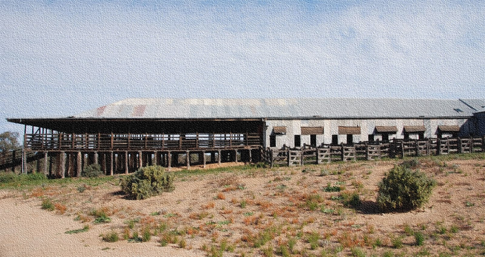
Our next port of call was Gum Bend Lake, 3kms out of Condobolin; a bit bigger town than the last. Gum Bend is a local family picnic/camping area that has its history in the mining past. Many towns that had mining industries early in the last century had an area away from town where the workers and their families could relax and escape the dust and dirt of their job.
We were looking forward to camping along a lake again but, to our dismay all we saw was a tractor driving around on the lake bed spraying the vegetation. We found out that the weeds were being sprayed because the man-made lake was to be re-filled in the next few days. Alongside the camping area, the Lachlan River is in full flow. It is from here that the lake is to be filled. It is so good to see lots of creeks & rivers with plenty of water in them; it’s been quite some time since we’ve seen water flowing like this. Many road-side ditches were still full and more rain has fallen since.
An obligatory meat pie had to be taken along the main street of Condobolin; several architecturally interesting old buildings to photograph. Among these is the old fire-station with the fire-alarm bell that was to be rung, but NOT for chimney fires!
We couldn’t have been persuaded to stay at the local, very nice caravan park; they were hosting two regional dog shows, imagine the noise! Across the road, preparations for the weekend Condobolin Annual Royal Show, hurdy-gurdies and fair-ground equipment was being erected and tested. More noise! Having enjoyed the quiet of remote area camps, we have been spoiled.
 Click on the link below to view some photoshttp://picasaweb.google.com/108879761974384702036/WhiteCliffsCobarToCondobolin?feat=directlink
White CliffsAfter spending six lovely quiet days in Copi Hollow, we headed back to Broken Hill for three days to top up supplies before heading up to White Cliffs. During the three days in Broken Hill, I was able to catch up with a cousin whom I didn’t know of until recently. It was good to be able to spend a couple of hours with her & find out more of my family ties. The weather was wild, wet & woolly for those three days.
While driving to White Cliffs we noticed that the landscape is now very green, a quite different view from what we saw the last time we drove this way in 2006; then it was very dry & farmers were driving their cattle/sheep along the roadside in order to find feed for them. Some farmers were even taking them up to 50kms away to find greener pastures. This year however, is quite different, significant rains across NSW/Qld have made a huge difference to the landscape. As we got closer to White Cliffs a sign said, ‘White Cliffs Opal Field: The First and Friendliest’.
White Cliffs is in a semi-arid area of Far Western NSW (approx 100km north of Wilcannia)-as such you will find stands of eucalypts, mulga, leopardwoods (quite a variety of trees in fact but not as in forests as you would find in coastal areas); there is a variety of low shrubs & grasses. In White Cliffs itself, much regeneration work has been done to rectify some of the mining practices of the past; so many trees were cut down to provide materials for housing and shoring up mine shafts. White Cliffs is known as Australia’s first commercial opal field. It’s documented that opal was found as early as 1884 by four kangaroo shooters. The town itself is small but spread out. From the air one can see a lot of white coloured craters which has been described as a ‘lunar landscape’. It has been estimated that at the height of mining activities, 50,000 holes were dug; this is evident from the air.
White Cliffs has a summer where daytime temperatures can reach 44-46oC for days on end, in order to escape the oppressive heat; miner’s homes are frequently built underground, often in the very mines themselves. These homes are known as ‘dugouts’ having been dug deep into the hillsides. These dug-outs can have all the conveniences of any modern home but are environmentally friendly, little heating or cooling is required with an all round temperature being around 22oC. With a population of approx 210, (which apparently is a floating population), there are about 140 dug-outs while the remainder of residences live above ground. After a morning walk around town, we got to see the Solar Power Station which incidentally, was the first commercial solar power station in the world. Originally the Power Station was established as an experimental facility by Australian National University researchers. It powered the local hospital, school, post office & twelve residences. The solar plant is now closed but has earned a national award that will see it preserved as a piece of alternative energy heritage. The White Cliffs Power Station is nationally recognised as an iconic engineering project equal in status to the Snowy Mountains Scheme, the Sydney Harbour Bridge & the Parkes Radio Telescope. A walk through the Pioneer Cemetery demonstrates the conditions that families endured in the harshness out here. Many young children died from Dysentery, Typhoid & Diphtheria. The youngest child being only 12hours old with the average life of a child was under 4 years of age. Later in the day we drove around some of the mines & did some fossicking of our own. Over the four days we manage to find a few small pieces of opal, nothing that will make us famous or rich though. We did however have a lot of fun fossicking. White Cliffs is the home to the “Opal Pineapple”; it is the only opal field where these collector’s pieces of mineral are found.
While in White Cliffs we were able to catch up with the daughter & family of my cousin whom we met earlier in Broken Hill. It was good to spend some time with them to reminisce over past family members. Peter, Joanne & Kaija their daughter live in a lovely dugout which they built themselves, next door is their first dugout, now a commercial tourist venue, PJ’s Underground B&B.
Just a quick note; while we lived in Aberfoyle Park, 20k from the city centre, we weren’t able to get ADSL or a good wireless broadband connection, here out in the middle of nowhere we were getting an ex cellent connection, best ever wireless performance; go figure!!
Click on the link below to view some photos of White Cliffs.
http://picasaweb.google.com/108879761974384702036/WhiteCliffsNSW?feat=directlink
KINCHEGA National Park, August 7th
Kinchega National Park is situated between the mighty Menindee Lake and the River Darling on the Eastern Boundary and encompasses Cawndilla Lake to the South and West and beyond. Approximately 44 000 Hectares in area, there are camping sites, scenic drives and historical locations to enjoy in typical semi-desert surrounds. After thousands of years as traditional Aborigine occupancy, the Park was once the 800 000 Hectares Kinchega-Kars Pastoral Lease; from 1870 to 1967 when the Kars Lease was dedicated as a national park. Instead of sheep, the park is now home to Kangaroos and Emu, numerous birds and apparently, a lot of desert reptiles of which we managed to keep clear.
The Park has several highlights, the original homestead site and the old original shearing shed is really something to see. In the shed are the left over overhead pulleys that drive the shears, old wool press and the steam-boilers that powered the original machines of the shed. The old shearing quarters have been restored and made into conference rooms, accommodation and catering facilities.
There are three self-guided drives around the park, subject to weather conditions, can be done with a 2-wheel drive vehicle. However, it only needs a little rain to make some areas very sloppy and boggy. The River Drive would be worse affected if wet. This drive though, proved to be the most interesting to us. After visiting the Shearing Shed, we found our way onto the river-side track and as the river winds itself in a serpentine manner, there were many scenic spots to photograph. The river over time has cut deep into the flat plains at the edge of the Park and most of the banks were quite steep to the water’s edge. There are pointers on the track indicating the floods of 1976 and 1983-1984, several feet above the existing banks of the river. Bird-life, Emu dad with chicks and the odd lazy kangaroo added to the pleasure of the drive. The “road” around the river is a 2-wheel track with dips, tight turns and overhanging trees. A highlight of the River Drive is the wreck of the Paddle Steamer Providence, Australia’s only inland ship-wreck. Only part of the boiler remains where it was blown to when an explosion demolished the boat and killed members of the crew. It seems that the crew had been sampling the delights of the Menindee pubs before stoking the boiler fire but forgetting to fill the water tank.
There are about 35 allocated camping spots along the river, ideal for tents and camper trailers but not suitable for our caravan; the sites are ok, just getting there would be dicey. Weir 32 is a popular spot and here we spotted several anglers that were actually catching fish.
Caravans can be camped at the Cawndilla Lake site; this is a good area at the lake side that should appease canoeists or bird watchers alike. Sunsets over the huge lakes are spectacular and when the air is still, the reflections of the submerged trees, clouds and the flaming red rays of the sun make for one of nature’s most beautiful sights.
Kinchega N ational Park, a place to visit again. Click on the link below to view more photos.
http://picasaweb.google.com/108879761974384702036/KinchegaNationalParkNSW?feat=directlink
Broken Hill - 'Art Gallery without the Walls'
After four lovely quiet days in Silverton, it was time to move on to Broken Hill. Apart from the 39 dips along the road back into town, the drive wasn’t too bad. I did count the dips, but somehow I missed 1 or 2 along the way. We chose to stay at the Broken Hill City Caravan Park; a bit more expensive than the other two in town, but after taking a quick look at them during the week, a much tidier park.
For the first half of the week we were kept quite busy visiting the many attractions, as one does. As we know, Broken Hill is an active mining town; the wheels are still turning at the Perilya headframe. For generations the miners work was backbreaking and dangerous with long hours and low pay. However, this all changed in 1920 when, after the miners being on strike for 18 months, they were awarded improved safety conditions, health conditions, health monitoring and for the first time a 35 hour week. The actions of these battling miners would eventually influence the rest of Australia’s working conditions.
Our first port of call was a drive up to the Line of Lode Miner’s Memorial and restaurant which stands prominent on the top of a mullock/slag heap behind the railway station. It was built as a memorial to the 900 or so miners who have lost their lives working along the Line of Lode. On 8th October 1902, two young lads (mullockers) Thomas 19yrs & Leopold 21 were killed by a fall of rock in Stope A5, 500ft level. Owing to the ground conditions their bodies have never been removed & remain the only fatalities still entombed on the Line of Lode.
After a good night sleep we decided to venture out to the Broken Hill Sculptures & Living Desert Sanctuary, but not until we had collected the gate key (we were a bit lazy & didn’t want to do the steep walk up to the sculptures). Each of the 12 sculptures is designed by a different artist. The artists came from Mexico; Tiwi, Bathurst Island; Tbilisi, Georgia; Damascus, Syria; Katoomba, NSW; Rustiva, Georgia; Koolewong, Australia & Broken Hill, NSW. Some of the carvings were obvious as to what they resembled while others needed to be explored closer. As quoted by Dr Ahmad Al Ahmad, sculptor “The symposium is a necklace for the maiden – the maiden being the incredibly beautifully desert landscape around the mountain.”
After spending time soaking up the ambience amongst the sculptures Colin headed back down the way we came while I walked down to meet him at The Living Desert Flora & Fauna Sanctuary. The view across the Barrier Ranges was stunning & most enjoyable. The 2km Sanctuary Cultural Walk is nestled within the 2400ha reserve protected behind an electric predator-proof fence. The trail had 9 points of interest along the walk including many clusters of the Sturt Desert Pea which is now in full flower. Fauna was limited to a few lazy old Kangaroos that wouldn’t stray far from the provided feed bins.
We just had to visit ‘Pro’ Hart’s (Kevin Charles Hart) Gallery while in Broken Hill. Pro started putting pen to paper at an early age. His correspondence school teachers were impressed with his talent that they encouraged him to run with it. When he was working down in the mines as a train driver he continued to paint. He often said that it was the only thing that kept him sane. We were so overwhelmed when we entered his gallery. I have not come across an artist who was able to display the variety of techniques, styles & medium. Not only was he an artist with paint, but also a sculpture. We had the opportunity to spend a short time talking with his widow, Raylee. Amongst the vast array of paintings, glass etchings etc; over 3 floors of his gallery, was his famous ‘Dragonfly’ masterpiece which he did on a piece of carpet; remember the ad? (“Oh! Mr Hart, what have you done?”). I’m sure he would have been an inspiration to any young artist who is setting out in this field of work. If you ever come to Broken Hill, why not call in to the gallery. We would recommend the visit.
Another point of interest was The Silver Tree. The tree was created by a German silversmith Henry Steiner in 1878-79 for a Melbourne exhibition. The tree is a fabulous & elaborate display of craftsmanship decorated with animals & outback figures. Over 600mm high & weighing 8.5kg, the tree is hollow & the base is beaten out to a single sheet of silver. Have a look at the link for details.
We found Broken Hill to be a great place to visit. It is a busy city; one event highlighted the way the town is, a person was mugged in daylight and it made big news because these things don’t normally happen in the town. It is considered a safe place to bring up your children. We found the people in the town shops, cafes and tourist venues to be very friendly and welcoming to tourists. We had some great home-made soup, chips and hot chocolate at one cafe. The local Toyota dealer went out of the way to get a small problem attended to. The City is bisected by the slag heaps from the Line of Lode Mining past. I think that this is an ugly reminder of the reason for Broken Hill. However of disappointment to these visitors, there is little to see that reflects the vast wealth that the town has created. Though the people are resilient to the downturns of the industry, they are creating work alternatives but the numerous old houses along the wide streets, the tired old shops, don’t reflect any of the opulence that the mines have created.
There is a lot of the classic Australia evident in Broken Hill and I can’t help but feel that there, the old values of mateship and tolerance will prevail.
Copi Hollow, August 3rd-6th
http://maps.google.com.au/maps?f=q&source=s_q&hl=en&geocode=&q=Copi+Hollow,+New+South+Wales&sll=-25.335448,135.745076&sspn=32.628652,54.580078&ie=UTF8&hq=&hnear=Copi+Hollow+New+South+Wales&z=10
We found this cute sounding place by accident, as you do. We were at Broken Hill and wanted to go south-east to have a look at the Menindee Lakes System, a huge water storage area of the River Darling. Many South Australians suspect that this is where all the water that should be coming down to the River Murray is being stopped.
We found a pamphlet about the caravan park at Copi Hollow, one of the smaller lakes. If you look for it on Google Earth, you will see that it is one of two lakes joining Lake Pamamaroo to the bigger Lake Menindee. The Caravan Park is owned by the Broken Hill Speedboat Club Inc; there isn’t much water near Broken Hill so the club members set up this place, about 110km away, for their chosen recreation away from the mines.
This is a good year to come as the lakes are all full and the surrounding land is covered in rich vegetation, a far cry from the previous dry years. All we need is for the fish to come back, no luck tempting them yet.
It is quite amazing to come across these lakes for the first time, the River Darling has wound its way though some of the driest semi-deserts of New South Wales; the land all around is pretty flat for hundreds of kilometres. The lakes must be a natural basin off of the river. Aborigines lived and hunted in this region for thousands of years and would have been used to the seasonal ebb and flow of the river and lake water levels, winter and summer seasons would have shown a marked difference. However, since Europeans came to Broken Hill, a reliable all-year water supply was needed so the Menindee Lakes Scheme was started. Construction of a Main Weir, several Control Blocks and additional channels to direct all water from the Darling into the Lakes for storage have since been the major source of water for Broken Hill and surrounds. There is a 100-odd kilometre pipeline connecting the precious resource to the north.
Attractions here of course include the lakes and many forms of water sports, trail bike riding; walking trails and just quiet relaxation. Probably not that quiet when the Speedboat Club is holding a regatta. Water Skiing is their main activity. The caravan park is a little village of around a hundred permanent caravans, lucky for us this week nearly all are unoccupied.
We have had a relaxing three days here, backed up on the lawns abutting the lake-front, feeding the friendly minor-birds, and catching up with a bit of writing and photo editing. Gorgeous sunsets before the rain!
A little ge m! Click on the link below to view more photoshttp://picasaweb.google.com/108879761974384702036/BrokenHillToCopiHollow?feat=directlink


